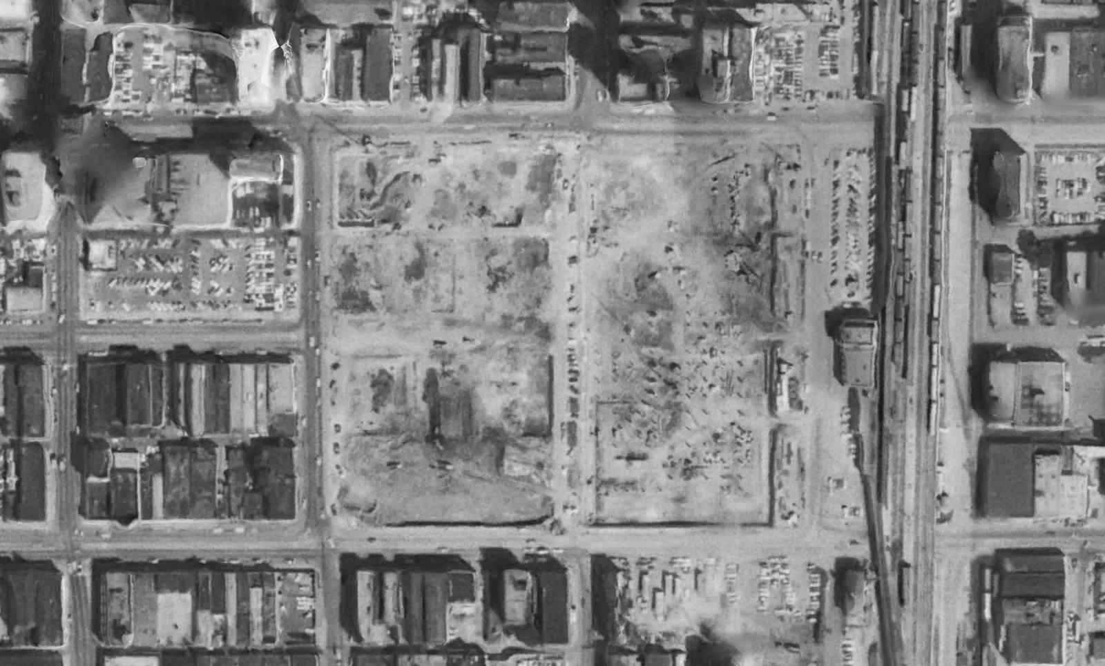
Historical Decade Package
Every year of one place,
on one grid.
A frame from every year the record holds, from the 1930s to this year, registered to the same ground and cut to the same footprint at the same scale, so the same fence line sits in the same place in every one. Ordered from a map, delivered as files and in the viewer, with the source and date on every frame.
What it looks like
One quarter section.
1941 to 2023.
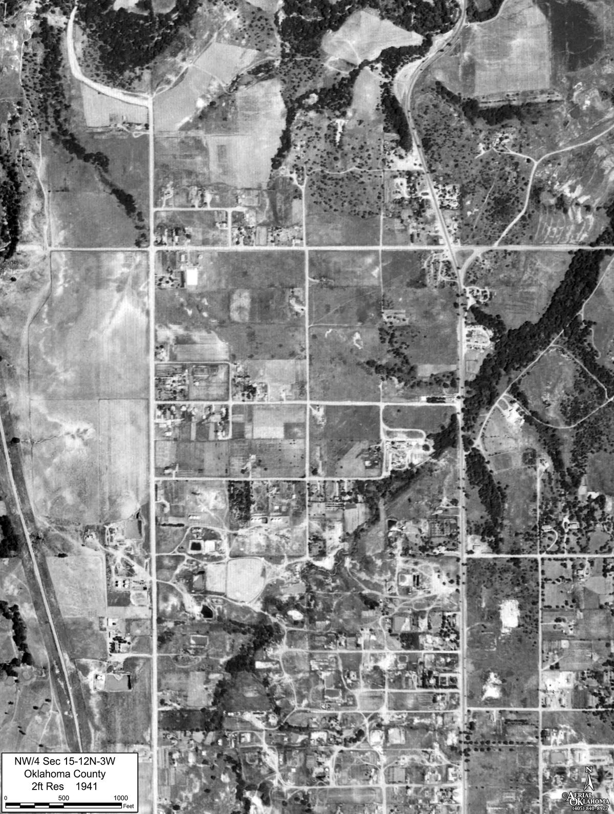
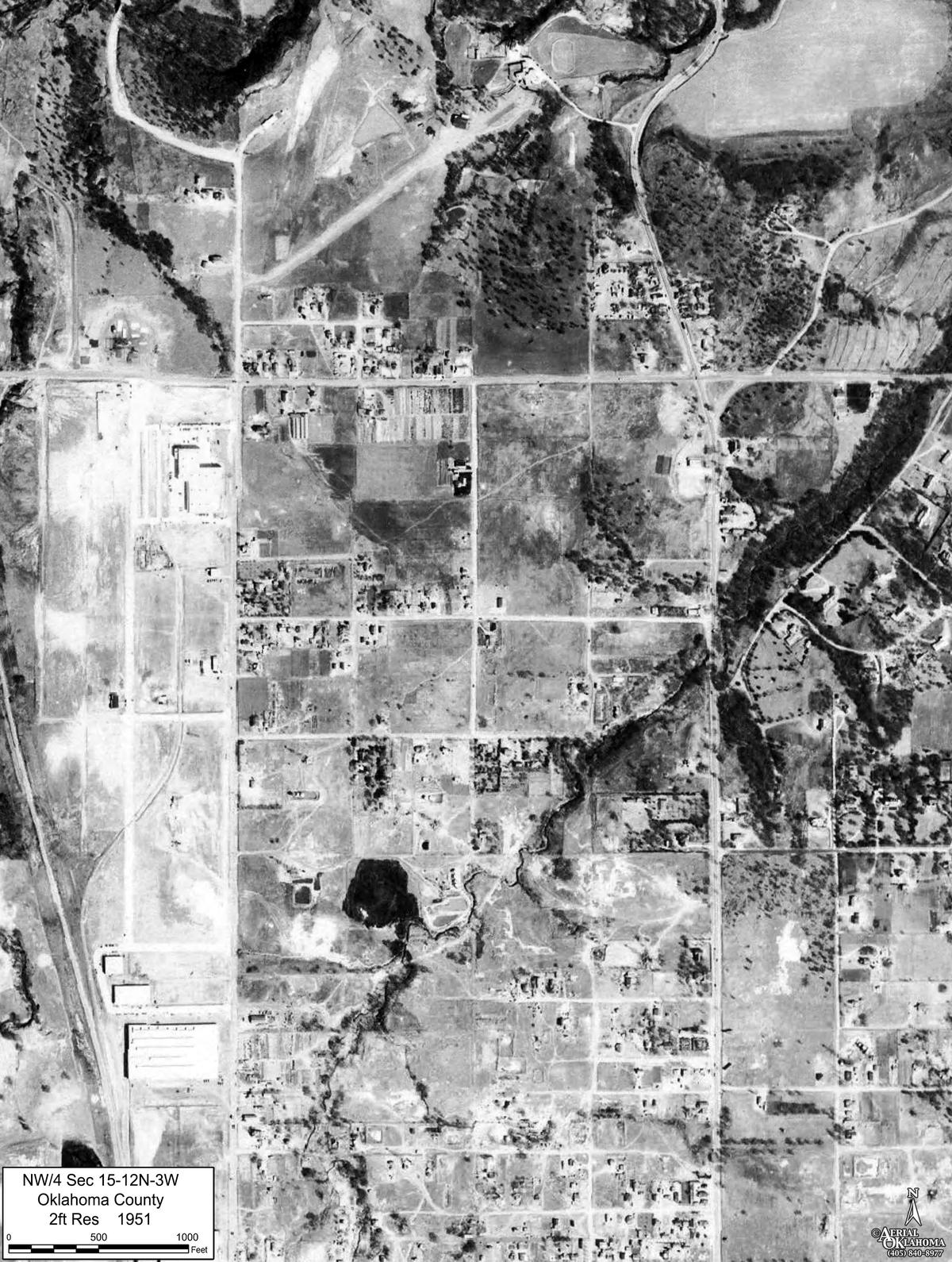
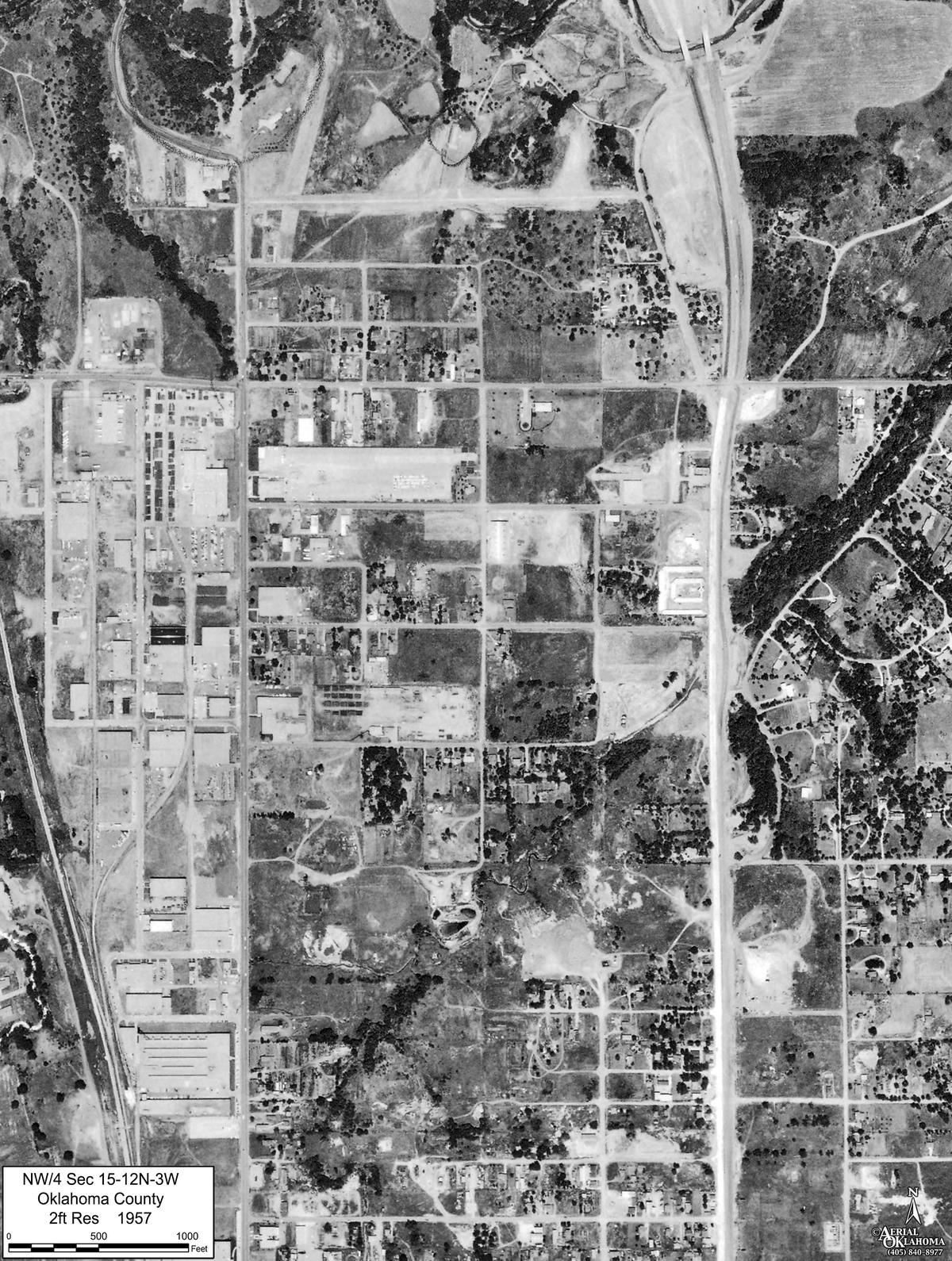
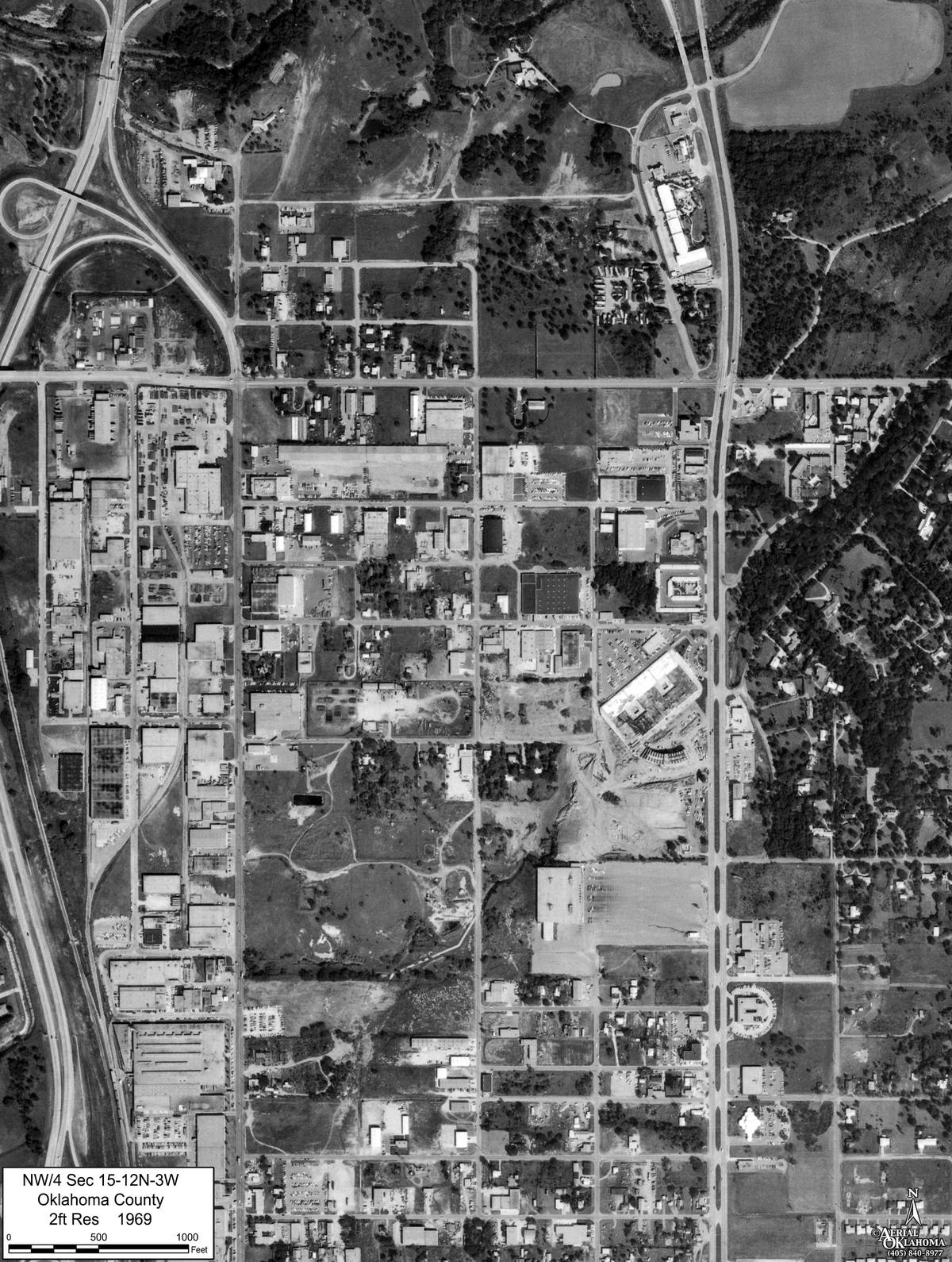
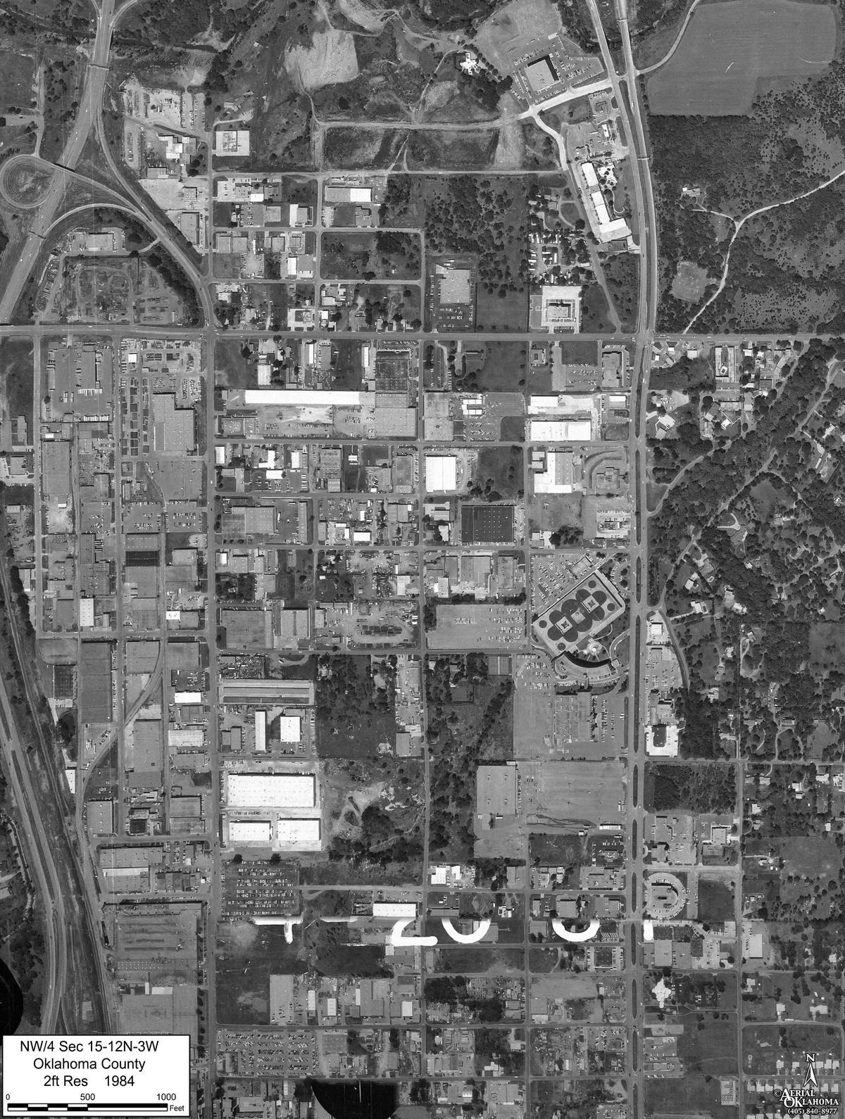
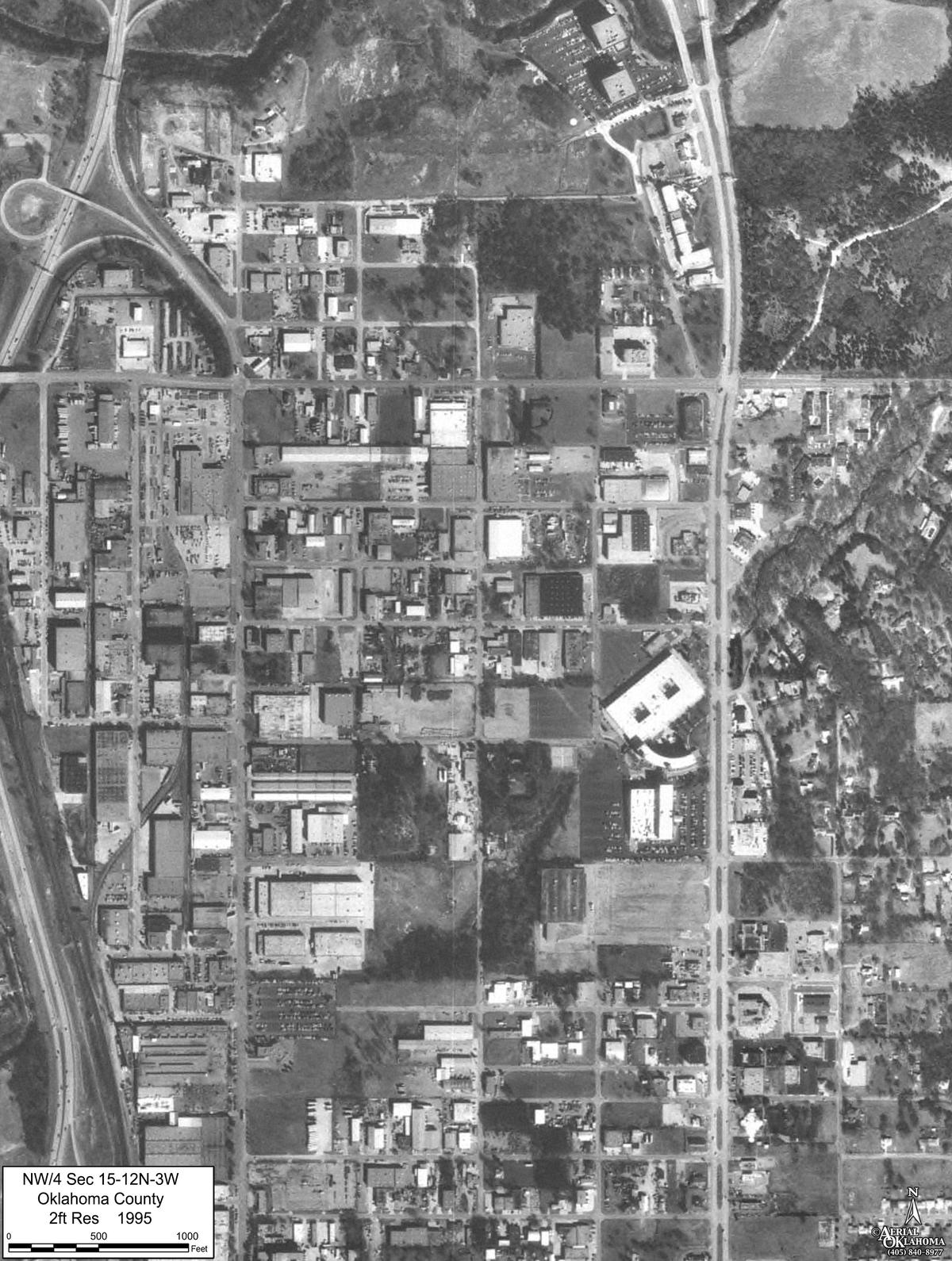
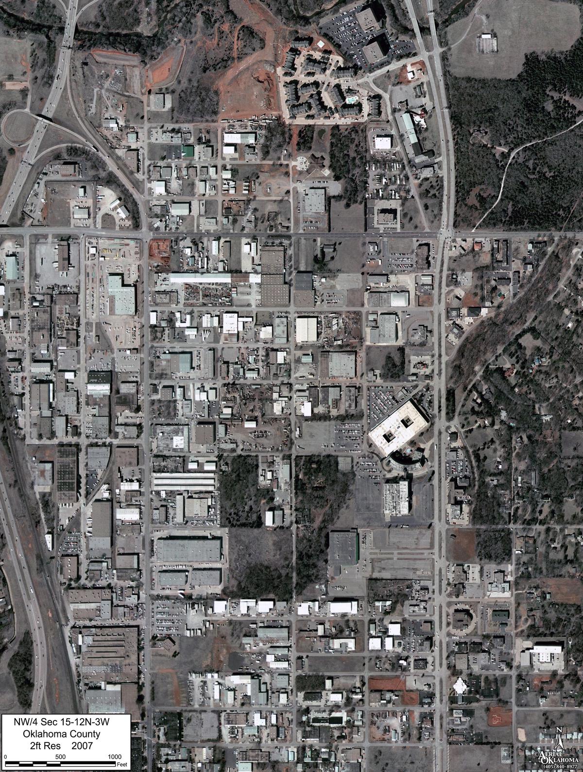
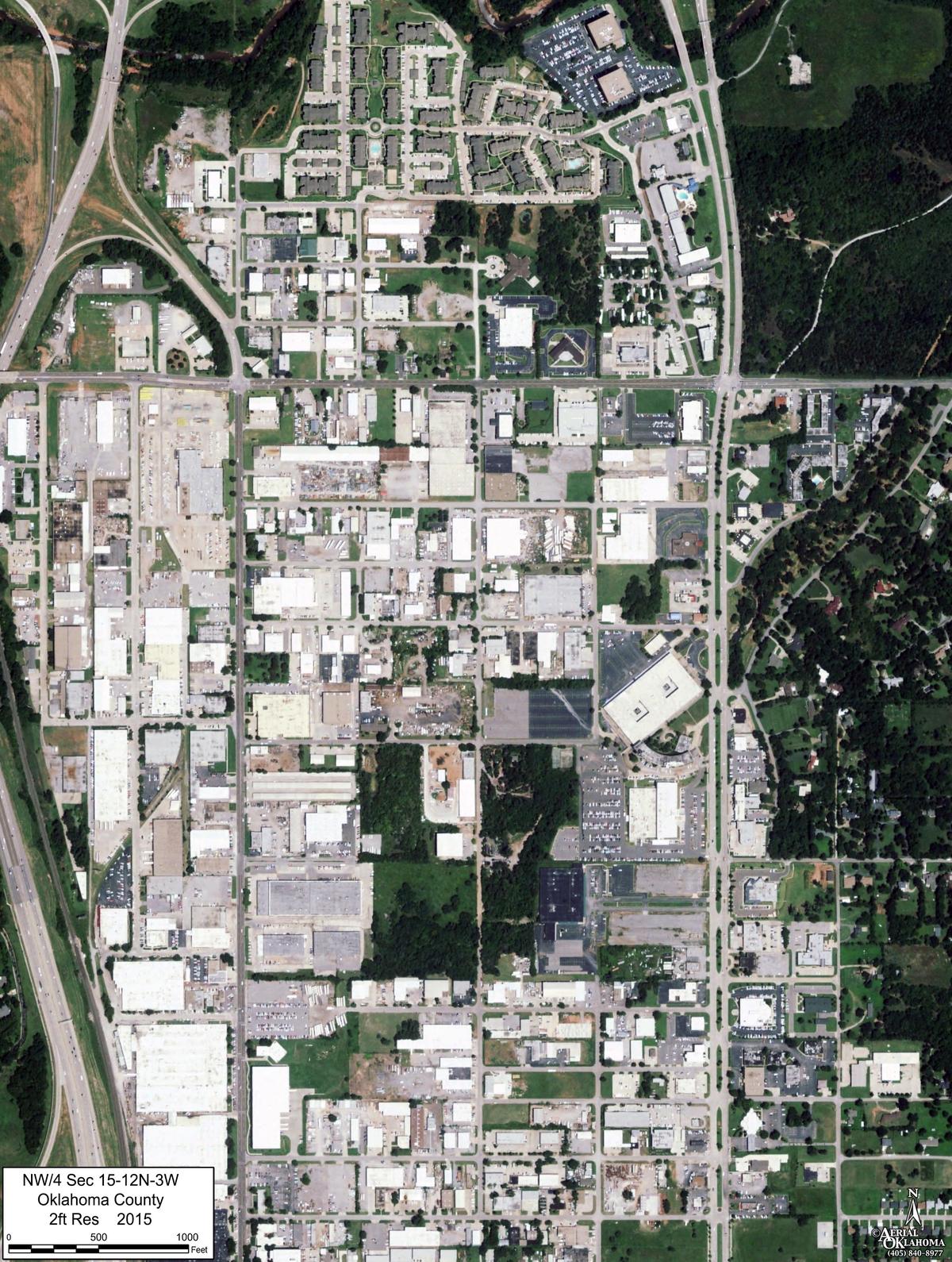
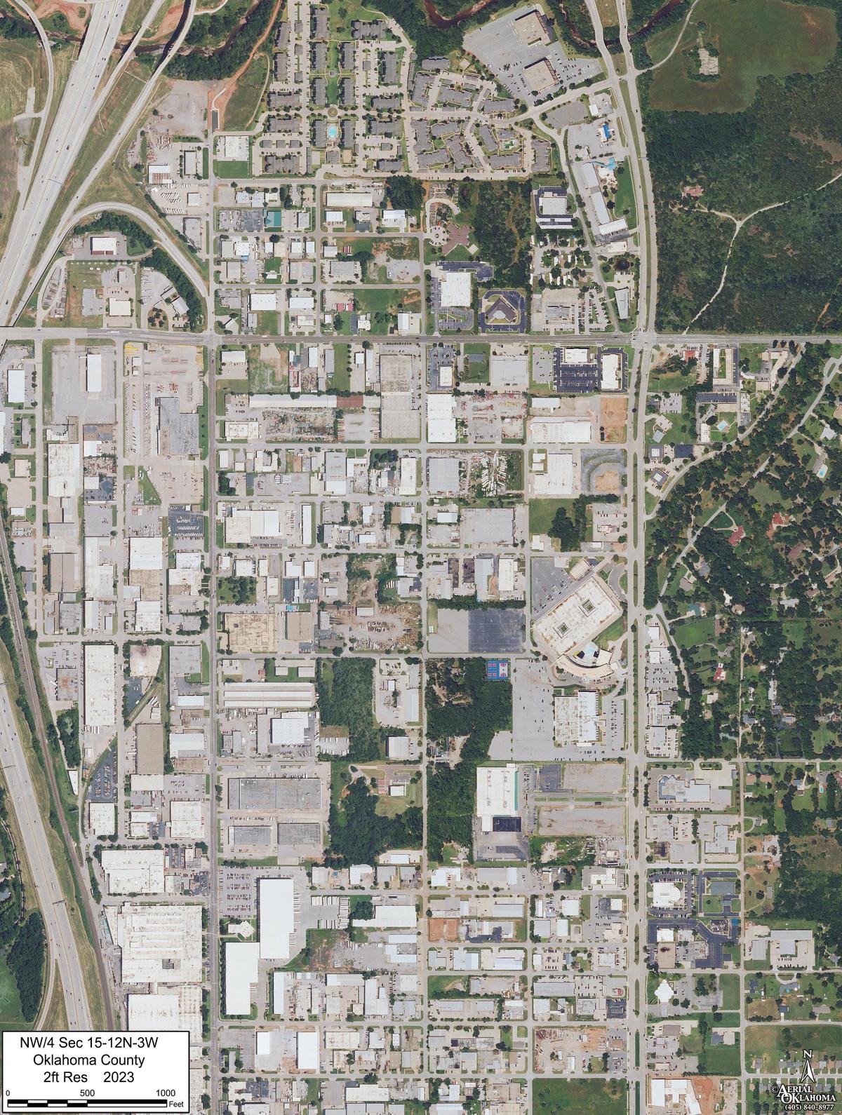
A package as delivered: the northwest quarter of Section 15, Township 12 North, Range 3 West, Oklahoma County, twenty-three sheets from 1941 to 2023, nine of them here. Every sheet is cut to the same footprint at the same scale with the year, the legal description and a scale bar in feet on it. Drag the slider, flip the years, and the ground stays put.
What's in the package
The record, made
to line up
The hard part of historical imagery is not finding a frame. It is making frames from different cameras, altitudes and decades agree with each other and with the ground. That work is the package.
-
The frames
Every year the record holds for the site, one frame each, from our survey coverage of the state and from the public record, picked for clarity over the site. Each carries its date and where it came from. Where a year has more than one usable frame, we say which we chose and why. Flights commissioned by clients are not part of the archive and never appear in a package.
-
Registered to the ground
Every frame is georeferenced to current mapping and cut to the same footprint at the same scale. A corner in 1954 is the same corner in 2026, so the years overlay, flip and slide against each other.
-
The files
GeoTIFF for GIS and CAD. GeoJPG and KMZ for Google Earth. A print-ready sheet per year at an engineering scale, with a scale bar drawn at its true length, a north arrow and the frame's date and source in the title block.
-
The viewer
The same set in the browser, on a slider, with side-by-side compare, measurement in feet and acres, and a link that carries the exact view to whoever needs to see it. Private if you want it private.
Where it's used
What was on the ground, and when
Most questions that reach us come down to a date. When did the fence move. Was the pond there before the pipeline. What did the parcel look like the year the easement was written. Was the site industrial in the decades a Phase I assessment has to account for. The package answers with pictures that carry their own provenance, on a grid a measurement can be taken from.
Counsel and expert consultants
Condemnation, easement and access disputes, environmental matters, boundary and title questions. Frames with a stated source and date, and plates that can be checked with a ruler. When a matter needs more than the package, that conversation is on the litigation support page.
Environmental consultants
Historical aerial review for Phase I environmental site assessments and remediation work: land use by decade, structures, staining, disturbance and drainage, all on one footprint so the years compare directly.
Title, appraisal and land
Occupation lines, roads, improvements and use across decades, for title work, appraisals, estate and family land questions, and for anyone who wants to know what their ground looked like before they owned it.
- SOLD SINCE2015, across the state
- SITEMarked on the map, or from a legal description or KMZ
- YEARSEvery year the record holds, one frame each
- SOURCEOur archive and the public record, named per frame
- GRIDRegistered to current mapping
- FILESGeoTIFF · GeoJPG · KMZ · PDF sheets
- ONLINESlider, compare, measure, share
- TURNAROUNDStandard sites usually go out in a day or two
Ordering
Mark the site. The quote comes back by email.
Drop a pin, draw the area, type a legal description or upload a KMZ. Say what it has to show if you know. The quote comes by email, usually the same business day, and the package follows as a link when it's done.
Questions
Before you order
How far back does the record go?
In much of Oklahoma, to the late 1930s, when the first systematic aerial surveys were flown for the federal farm programs. Earlier than that is rare anywhere. Coverage in the 1940s and 1950s varies by county; from the 1960s on, most of the state has a frame in every decade. We tell you what exists for your site before you commit.
Do you cover sites outside Oklahoma?
Our archive is Oklahoma. For a site elsewhere we build the package from the public record, which is thinner in some decades and some places, and we say what we found before you order.
Can I buy a single year instead of the package?
The package is the product. Its value is the sequence, and the registration work is much the same whether one frame is delivered or all of them. If your matter turns on one particular date, ask: we'll tell you what the record holds for that date and how it fits in a package.
What does it cost?
It's priced per site, from the map. Mark the site on the order page and the quote comes back by email, usually the same business day, with nothing owed until you say go.
What do I need to give you?
Where the site is, in any form you have: an address, a pin on the map, a drawn outline, a section-township-range, or a KMZ from another job. If it has to show something in particular, say so; it changes which frame we pick within a decade.
Will it stand up in a dispute?
Every frame carries its source and date, and the way it was registered can be described. Exhibits built from the archive have been used in condemnation and easement matters in Oklahoma. When a matter needs a declaration or testimony about the imagery, that is discussed with counsel case by case; see litigation support.
Could a flight I commissioned end up in someone else's package?
No. A flight you commission is yours. It is not filed in the archive, and it is never sold or licensed to anyone else. The archive is our survey coverage of the state, the collections we digitized, and the public record.
Does it work in Google Earth?
Yes, the KMZ opens in Google Earth Pro, and the GeoTIFF opens in any GIS or CAD package. The same set is also in our viewer, which needs nothing installed, and which is where it will keep working after Google stops offering Google Earth Pro for desktop as a download on 25 June 2027. Installs you already have keep working.
Contact
Ask about a site
Not sure what the record holds for your site, or what it has to prove? Describe it here and we'll say what exists before you order.
Oklahoma City, OK 73118