Share a view
The link carries the camera, the plan or 3D mode, and any measurement, so the person you send it to lands on the same view.
view.aerialok.com/?p=…&cam=…
The viewer · view.aerialok.com
Every job we deliver opens in a browser: the model, the flights on a timeline, the historical frames, and the tools to measure, compare and print to scale. Nothing to install, no GIS seat to buy, and the link carries the exact view to whoever needs to see it.
Live, not a screenshot
Every one of them opens the real viewer, the same one clients use. Nothing to install.
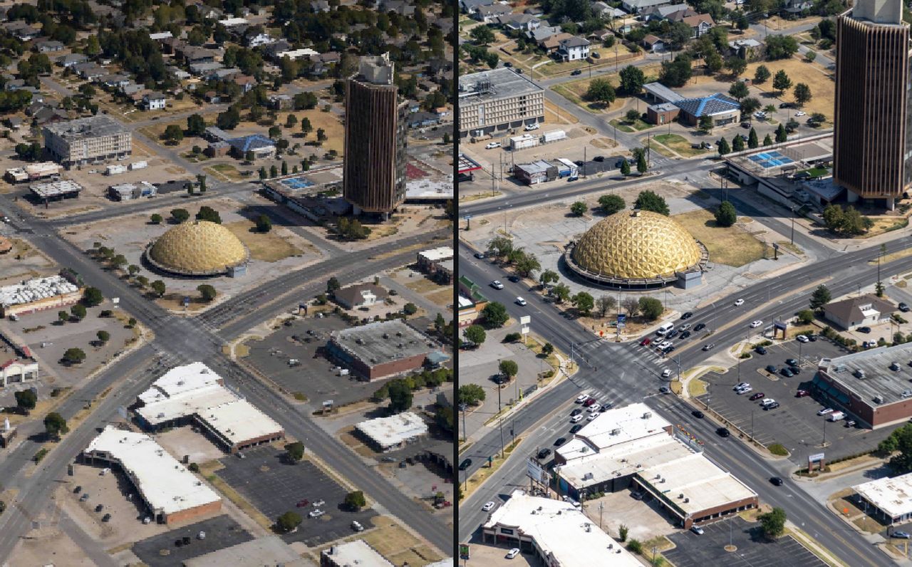
Thirty flights of one dam rebuild, opening with January 2021 left of the gold divider and February 2026 right. Drag the divider, pick any other two dates, scrub the timeline, measure anything you can see. The second button is the same idea at a different tempo, the tank farm at Cushing, flown forty-seven times in eleven months, where the floating roofs rise and fall as you scrub. Nothing to install.
Obliques, with the model
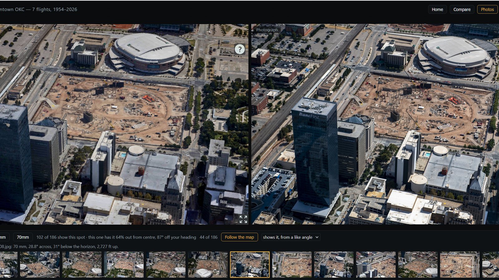
Downtown Oklahoma City on one September morning: 186 frames on two lenses, every one solved to the model, on a project that also carries seven flights back to 1954. Steer the model and the frames that show what you are looking at come to the front; pick one and the model turns to match it. The second button loads the Gold Dome, the first job that tied photographs to a model.
In the viewer
Everything here runs on the same model in the same browser tab, so a measurement, a compared date and a scaled sheet all agree with each other.
Switch to plan view and the model locks north-up and straight down, with no convergence, so the scale bar is right everywhere on the screen, the way a plat is. Measure lines, paths and areas against the model. The figures update live as you place corners, the corners drag, and they snap to the linework you're working from.
FOR right-of-way agents · appraisers · counsel
Frame a view and export a finished plate at an engineering scale: imagery, linework, legend, title block, north arrow and scale bar. The bar is drawn at its true printed length, so a ruler on the paper checks the scale without trusting the number above it. Nothing appears on the sheet unless it's on the screen.
FOR trial exhibits · condemnation · appraisal
 70 MM · FRAME 5 OF 6
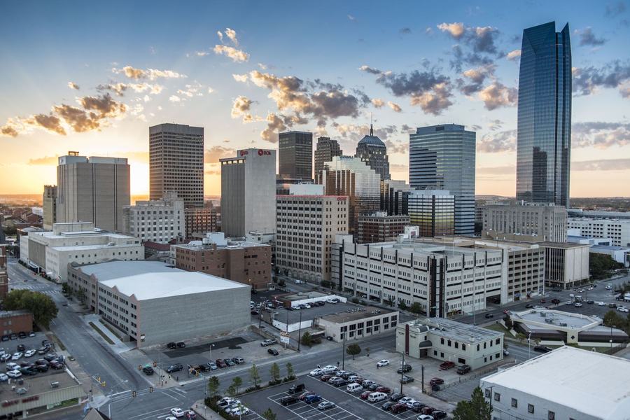
Oblique jobs open straight onto the photographs. When a job has a model too, the split view puts the model on one side and the photograph on the other at the same angle, and the frames that show what you're looking at move to the front as you steer. Filter by lens; the client downloads one frame or the whole set.
FOR commercial real estate · utilities · marketing
Recurring flights sit on one timeline. Scrub through them, or put any two flights side by side with a gold divider and compare them directly. Each flight is flown the same way every time, so the change you see is change on the ground, not a different camera.
FOR utilities · generation sites · construction
Delivery
Large KMZ attachments get bounced by agency mail servers. A link doesn't, and it opens on exactly what we meant you to see.
The link carries the camera, the plan or 3D mode, and any measurement, so the person you send it to lands on the same view.
view.aerialok.com/?p=…&cam=…
KMZ, GeoJPG and zipped photo sets are in the viewer's Downloads tab, grouped by flight or by year.
KMZ · GeoTIFF · GeoJPG · ZIP
Client work is gated inside the same tool, and the gate is the link you were sent. A shared exhibit never shows anyone the rest of your project list.
gated per client
A laptop in a deposition, a phone on site, a tablet in a board room. Nothing to install and no license to buy.
no plugin · no GIS seat
Getting around
The model moves the way a map does, with one more axis. Drag to pan. Scroll to zoom. Hold Ctrl and drag to tilt and orbit, which is the move a middle mouse button makes and the one touchpad users ask about most. Plan view locks the camera north-up and straight down, so the scale bar is right everywhere on the screen; switch back to 3D and it's loose again.
The same controls work on a phone or a tablet with one and two fingers.
If your files open in Google Earth Pro
Google is ending downloads of Google Earth Pro for desktop, and most aerial deliverables of the last twenty years were made to open in it. Existing installs keep running for now, but new machines won't get it. Every job we host is already in the viewer, and the KMZs you already have keep working in the meantime.
| For this job | Google Earth Pro | AerialOK viewer |
|---|---|---|
| Historical imagery | Google's imagery, no stated source | +Source and year on every frame, aligned by hand |
| The ground itself | Imagery draped on coarse terrain | +Photogrammetric mesh from our own flights |
| Scaled plan view | None | +True orthographic, one scale edge to edge |
| Printing | Screen capture | +Plates at 1" = 100' and 1" = 660' |
| Legend | Made by hand | +Built from the layers that are drawn |
| Sending it | Attach a KMZ | +A link, private if needed |
Contact
Older deliverables, KMZs from other vendors, a folder of frames from a case: describe what you have and we'll say what it takes to put it in the viewer.